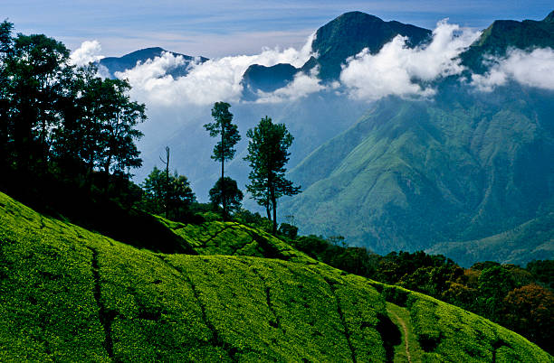
To look at a map of India is to see a nation defined by its rivers. Yet, the fate of those rivers—the Krishna, Godavari, Kaveri, and hundreds of mountain torrents—is decided not in the plains, but along a single, continuous mountain wall. The **Western Ghats**, or *Sahyadri*, are the climate anchor of the Indian peninsula.
However, because the Ghats traverse six distinct states—Gujarat, Maharashtra, Goa, Karnataka, Tamil Nadu, and Kerala—their administration has historically been fragmented. True conservation awareness begins when we look past state borders and recognize the Sahyadris as a single, living ecological corridor. Today, the future of this UNESCO World Heritage Site is suspended at a historic policy crossroads, shaped by two highly contested governmental reports that proposed starkly different paths.
"The mountains do not speak Marathi, Kannada, or Malayalam. A landslide triggered by quarrying in one state chokes the rivers and reservoirs that sustain the farming communities of three states downstream."
Two Committee Visions: The Core Debate
Between 2011 and 2013, the Ministry of Environment and Forests commissioned two expert panels to study the rapid degradation of the Western Ghats and propose a unified conservation framework. The resulting reports laid out two fundamentally opposing philosophies of how humans should interact with fragile natural systems.
1. The Madhav Gadgil Vision (WGEEP, 2011)
Led by renowned ecologist Dr. Madhav Gadgil, the Western Ghats Ecology Expert Panel (WGEEP) put forward a radical, ecology-first framework. The Gadgil report proposed treating the **entire mountain range** (all 160,000 square kilometers) as an Ecologically Sensitive Area (ESA).
The key pillar of the Gadgil report was grassroots democracy. Instead of centralized forestry departments making decisions, it recommended that local **Gram Sabhas (village councils)** hold veto power over any infrastructure development, quarrying, or land-use changes. It called for a complete phase-out of mining, large-scale dams, and chemical pesticides, transitioning the entire range toward organic agriculture and community-led conservation.
2. The Kasturirangan Compromise (HLWG, 2013)
Faced with intense political opposition from state governments claiming the Gadgil report would lock up developmental progress, the government appointed a second panel led by rocket scientist Dr. K. Kasturirangan.
The Kasturirangan report took a compromise-oriented approach. Instead of the entire range, it recommended protecting only **37%** of the Western Ghats as ecologically sensitive, designating the remaining 63% as a "cultural landscape" open to infrastructure, urban growth, and industrial development. It moved the decision-making authority away from the Gram Sabhas back to centralized state departments, attempting to balance industrial development with ecological safety.
| Feature | Gadgil Committee Report (2011) | Kasturirangan Committee Report (2013) |
|---|---|---|
| Protected Area | 100% of the Western Ghats (divided into 3 sensitive zones) | Only 37% (classified as the natural landscape) |
| Local Governance | Maximum (Local Gram Sabhas hold development veto power) | Low (Decisions remain centralized with state boards) |
| Mining & Quarrying | Complete ban and immediate phase-out across the range | Banned only within the designated 37% sensitive zone |
| Dam Construction | Complete ban on large hydroelectric dams | Allowed with strict environmental impact clearances |
Raising Awareness: Why the Policy Crossroads Matters to You
Why should a citizen in Mumbai, Bengaluru, or Chennai care about this administrative debate? Because policy directly dictates land-use, and land-use directly dictates ecological safety.
In recent years, the consequences of compromising on ecological sensitivity have become terrifyingly clear. High-intensity monsoons, amplified by climate disruption, have triggered devastating landslides and flash floods in areas that both reports identified as highly sensitive.
Unregulated stone quarrying on steep slopes, extensive forest clearance for linear infrastructure (like roads and power lines), and the filling of high-altitude wetlands have stripped the mountains of their natural anchoring capacity. When a slope is destabilized by development, the soil cannot hold the monsoonal rain—leading to catastrophic run-offs that wash away entire villages downstream.
A Call to Democratic Conservation
The core lesson of this policy crossroads is that true conservation cannot succeed through top-down enforcement alone. It requires building public awareness and empowering local communities to become active participants in protecting their watersheds. Safe mountains mean safe rivers, which sustain us all.
The Path Forward: Collaborative Governance
The solution lies not in choosing one report over the other, but in building a new model of collaborative, data-supported governance. Local Panchayats and communities must be given the technical support to monitor their own watersheds, count their forest carbon, and map sensitive soil zones.
By raising public awareness about the fragility of the Sahyadri range and supporting policies that respect the rights of nature, we can move toward a future where development does not require ecological destruction. The mountains have anchored our subcontinent's climate for millions of years—it is time we anchor their safety in our policies.